Jan 11, 2021
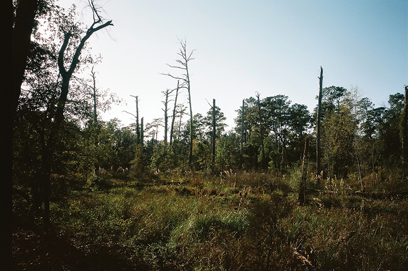
A clearing in the forest. The boardwalk has brought you here, as if to show it to you. But why?…


The Houston-Galveston Area Council maintains something called the Regional Travel Demand Model. It divides five counties in the Houston region into more than 5,000 zones, some as small as a single block. It tabulates trips from each of these zones to every other zone — some 2.5 million trip combinations. From a little 20-block section of Montrose, it says, there are 3.07 trips to Rice University, 2.19 trips to the Pennzoil Place tower, and 1.20 trips to a subdivision on the north side of Hughes Ranch Road, in Pearland. And then it projects this information forward by 25 years. The model asserts that it knows where people in that neighborhood will work, where they will eat, where they will shop, and where their friends will live in 2045.
This kind of projection seems audacious. But that is the nature of transportation. The infrastructure we design today will take years, even decades, to build, and it likely will last far longer. Every dollar we spend on a road, a sidewalk, or a rail line is a prediction of the future: an assumption of what future Texans will want or need.
In Austin, such a projection is being expressed on PowerPoint slides. The region, TxDOT asserts, is projected to grow more than 70 percent by 2045, and therefore: “Annual average traffic along I-35 from U.S. 290 East to SH-71/Ben White Boulevard is more than 200,000 vehicles per day. By 2045, it is expected to reach more than 300,000 vehicles per day, an increase of more than 45 percent.” The presentation is part of a public meeting — virtual, in these COVID-19 times — for a new project that could spend $7.5 billion on widening 27 miles of I-35. This is the scoping phase, the time in the federally required analysis process where an agency states the “purpose and need” for a project and identifies alternatives. TxDOT has developed three options for rebuilding the highway. The first would add four managed lanes in a tunnel. The second would add four managed lanes next to the freeway lanes. The third would add four managed lanes sometimes next to the freeway lanes and sometimes on an overpass. Every option (other than the “no-build” alternative included as part of any environmental impact statement) adds lanes; the typical section that TxDOT is posting shows a 12-lane highway becoming a 20-lane highway.
The widening of I-35 in Austin is an assertion that traffic will inevitably continue to increase, and that the only way to handle that is to add traffic lanes. This is a direct projection from the past, a continuation of a decades-long strategy used as Austin grew from 130,000 people in the 1950s to 978,000 today. I-35 was built in the 1960s along the old East Avenue, a six-lane road. The original highway had four lanes, two in each direction. In the 1970s, four lanes were added in an elevated structure. Meanwhile, MoPac got new managed lanes; State Highway 71 and U.S. Routes 290 and 183 have been rebuilt as freeways; and State Highways 130 and Loop 360 have been built to bypass Austin on both sides. Even with all this new infrastructure, traffic on these roads increased. The distance the average resident of the Austin region drives increased for decades. TxDOT sees a freeway where traffic travels at 15 mph at rush hour and concludes that the only reasonable response is to add lanes. The question this workshop poses is what the best way is to add those four new lanes, and how to minimize the impacts those lanes will inevitably have on the city.
However, those additional highways have been as much a cause of additional driving as they have been a result of it. While the change in the Austin skyline is dramatic, the biggest change has been in the suburbs, where rolling countryside has been transformed into subdivisions, office parks, and power centers. In the past decade, the city itself grew by 180,000 people, and the rest of the region by 320,000. Infrastructure may try to respond to travel patterns, but as soon as it’s built, it changes travel patterns. If we build more traffic capacity, people make different decisions on where to live, where to work, where to eat, even when to travel. Adding capacity adds more trips. In Houston, the widening of the Katy Freeway from 10 lanes to as many as 26 decreased peak-hour travel times by 25 percent — but then traffic started slowing down again. Six years later, traffic speeds were back to where they had been, because traffic on the freeway nearly doubled. In Austin, the numbers show that traffic on I-35 isn’t, in fact, going up — it’s been steady for a decade. But more lanes will almost surely mean that more people will use the freeway.
The proposed I-35 project isn’t really a strategy for reducing traffic congestion; it’s a strategy for growth. It’s a statement that the Austin of the future should be a city in which it’s easier for more people to drive farther, one in which new growth is car-oriented. Projects across the state encapsulate this vision: Interstate 820 is spurring new logistics development on the north side of Fort Worth, and the Grand Parkway is enabling Exxon to move its headquarters to a new suburban campus and sprinkling new subdivision across the Katy Prairie. 1950s highway planners drew lines for freeways through areas that barely had enough existing traffic demand for two-lane highways. As a state, Texas grew and prospered in the world those highways created.
But highway expansion is only one possible future. Highways have enabled Austin and its economy to grow, but they were not necessary. Some U.S. cities — including cities like San Francisco and Cambridge that Austin competes with for jobs and talent — did not build freeways through their downtowns. Others, like Seattle, have largely stopped widening them.
In Texas, too, we can see alternate visions for a transportation future. On the Texas Central website, a video follows a business traveler on a future trip from Houston to Dallas, 90 minutes by high speed train. Texas seems like an odd spot for the first full high-speed rail line in the Western Hemisphere. But these two cities are the perfect distance apart: too far for an easy drive, but close enough that a train can actually beat the airport curb to airport curb travel times for a plane. The project is premised on the prediction that business travelers will pick the train over Southwest Airlines, and that seems likely. It’s also a bet that having this connection will change the nature of Texas, that creating a fast, reliable connection between two of the 10 largest metro areas in the country will enable people to make that trip more often, increasing the business links between them and making the Texas Triangle more of a megalopolis.
On November 3, 67 percent of Austin voters voted for a $7.5 billion transit plan; last fall, a massive Houston transit plan passed with 68 percent of the vote. While this is small compared to highway funding (each city has a single highway project that matches the cost of the entire transit plan), it is clearly a vision for transit playing a larger role. It’s not just the spending that’s significant; it’s where the transit goes. Many of the cities that expanded rail systems in the 1990s — Denver, Dallas, Salt Lake City — were focused on suburban commuters going to downtown, expanding the transit network outwards, building big park-and-ride lots and routing trains along existing rail corridors to speed up long trips. The Houston and Austin plans, though, will improve and intensify transit in the heart of the city. In Houston, new lines will connect the city’s multiple activity centers to each other and run through the center of some of the city’s densest neighborhoods. In Austin, rail will run down the South Congress-Guadalupe-Lamar spine and out along the rapidly densifying Riverside corridor. Both cities recently redesigned their bus networks, and both of these transit plans build on these redesigns, upgrading busy bus routes to rail or bus rapid transit in dedicated lanes, and creating connections where crosstown bus routes intersect. Where earlier rail lines were designed for people to arrive in cars (DART has 24,000 parking spaces), these plans are designed for people to walk to the stations, or to catch a local bus. They are also designed to improve the trips of current transit riders, many of whom are low-income people of color. Houston’s plan includes new lines that connect predominantly Black and Hispanic neighborhoods to jobs and colleges, crossing the city’s east-west divide. Austin’s transit plan includes $300 million for anti-displacement measures, including the development and maintenance of affordable housing and financial assistance for homeownership. Both plans have major investment in improved bus stops and sidewalks. Both Houston and Austin are projecting a future where the city is not only more transit-oriented, but more equitable.
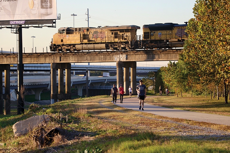
Not all projections are as infrastructural as a freeway tunnel, a rail viaduct, or a bus rapid transit (BRT) station. In Houston, a new vision of the city has taken shape by means of 10-ft strips of concrete. A decade ago, the Houston Parks Board floated a vision: 150 miles of pedestrian and bike trails along Houston’s bayous. In some cases, these would be upgrades of existing paths, but half would be new paths on land that had previously been closed to public access. In 2012, the voters put $100 million in bonds alongside $120 million in private funding, and this year the vision is largely complete. The greenways literally create an alternate connectivity for the city, going where roads and sidewalks don’t. At freeways, they cross under mainlines and frontage roads. They cross under railroads, bridging barriers that otherwise divide neighborhoods. The Houston Bike Plan calls these “high-comfort bikeways,” but that doesn’t fully capture the experience of passing through Houston surrounded by greenspace, going for miles without encountering a car, and feeling like people on bikes are not just being accommodated, but welcomed.
Unlike on I-35, there was no existing traffic to count along the bayou. Bayou Greenways was a vision of people moving through Houston in a new way, a projection that people all over Houston — not just those in old, walkable neighborhoods but also those in the postwar sprawl outside the loop — would want to walk or bike. That projection seems to have been borne out: Every day, there are people out on the greenways, and through the summer of 2020, with indoor recreation limited, the bayous were full of people. The Houston BCycle bike share set usage records, even in 90-degree weather, and the stations along the bayous were among the busiest. Creating a new kind of transportation infrastructure changes how people travel.
The transportation network that most directly shapes Texans’ daily lives is local streets. Traffic engineers have long classified streets in terms of a balance of through traffic and local access: Local streets are predominantly access; highways are predominantly through traffic; and collectors and thoroughfares fall in between. Streets carry people in cars, in buses, on bikes, and on foot. They also facilitate emergency response, parking, deliveries, drainage, green space, and gathering — and they provide a front-door context for buildings. Over the past 50 years, in Texas and across the United States, most of these uses have been made secondary to through traffic: Parking lanes have been converted to through lanes, sidewalks have been narrowed to the minimum, and trees have been cut down to make more room for lanes and minimize hazards to moving cars. Cities have been designed for moving through, not pausing.
In Dallas, though, Greenville Avenue expresses a different vision: the city’s new complete streets policy. Where there had been two traffic lanes in each direction, there is now one. There are on-street parking spaces in front of business. At the intersections, curbs extend out, shortening cross walks and providing space for bike racks. Trees line the sidewalks for shade, and benches invite pausing to watch the world go by. All these modifications also create another change that is more subtle: Drivers will not go as fast when there is visual complexity and lanes are constricted. This street is designed as a destination, not as something to pass through. It’s designed to work for people, not just for drivers.
Greenville is also designed to be safer. All of the state’s major cities have now adopted “Vision Zero” policies — pledges to aim to have no deaths in traffic. That seems like an obvious goal, but it is not. Street design standards have generally prioritized traffic capacity and speed over human lives. Right turn on red is dangerous for cars and pedestrians alike, but it increases how many cars can make it through the intersection in each signal cycle, so we allow it. The times that pedestrian signals are on ‘walk’ are set so short that studies show some elderly pedestrians cannot make it across in time, and yet longer signal timing would hold up cars. City thoroughfare plans mandate a minimum spacing between traffic signals so that they don’t slow down cars, forcing pedestrians to detour or make a dangerous dash across an intersection with no traffic signal. In fact, national standards require five crashes within 12 months in an intersection before a signal can be installed based on safety.
The traffic design standards that Vision Zero is taking on masquerade as technical, but they are in fact value judgments. A traffic model can calculate how much converting a car lane into a bike lane might slow down cars (though those models are imprecise). A traffic engineering standard can assign that level of delay the designation of “Level of Service D.” But those calculations cannot decide how important slightly faster trips for people in cars are, compared to safer trips for people on bikes. They cannot decide what an “acceptable” level of delay or safety is. Transportation decisions are not laws of physics; they’re value decisions.
Just outside Downtown Houston, the White Oak Bayou Greenway runs alongside I-10 and I-45, crosses under freight rail and the occassional Amtrak, and offers views of light rail trains along Main Street. The families biking along on a Saturday afternoon, the pickup trucks speeding on the highway, the transit riders commuting in from the Near North Side, the engineer bringing in a train from Los Angeles: All are experiencing different cities, different visions that coexist in the same space.
So what will this place look like in the future? As part of its North Houston Highway Improvement Project, TxDOT is proposing to widen the highway, adding more lanes, taking up more space, blocking some of the views from the greenway. Meanwhile, METRO is proposing BRT lines to Uptown and Greenspoint; the Houston Parks Board and Buffalo Bayou Partnership are working to extend the greenway to the Near North Side and the East End; Harris County is building bike lanes; the City of Houston is adopting a Vision Zero plan; and the University of Houston-Downtown is planning its campus expansion. Some of these projects are complementary — those greenways will connect to the BRT stations — but others conflict directly, literally trying to use the same space concurrently for different purposes. Travel demand models hide this reality. The “need” to add traffic lanes is no more fundamental than improving transit, creating comfortable bike facilities, or expanding a university. Widening a highway is a decision, just as building BRT or a greenway is.
We can also ask what projects are being forgotten. The freight trains that pass through here, for example, are frequently delayed for hours by Tower 26, an at-grade crossing a mile to the east. Railroads are more economic and have lower environmental impact than do 18-wheelers. But, because railroads are private, for-profit corporations, while highway infrastructure is subsidized by taxpayers, outdated infrastructure delays trains and impacts the neighborhoods that those trains pass through. Some places have tried to improve this situation — in the 1940s, El Paso built a trench through downtown, allowing trains to move more smoothly while eliminating downtown street crossings — but such projects have been rare.
Narrowly viewed, these are all simply projects, infrastructure to be built and designed. But all are visions for what kind of place Texas will be, statements about what we value. Transportation is political, and it always has been. The Interstate Highway System garnered bipartisan support, but it did not work for everyone. Highways were bulldozed through Black and Hispanic neighborhoods — the same neighborhoods redlined by government housing policies — in order to speed commuters to newly created suburbs and resulting in the re-segregation of metropolitan areas. That dynamic is still in play, today. For example, 12 local elected officials (mainly Democrats) around the I-45 project signed a letter to TxDOT asking the agency to reconsider its plans, and both the Mayor of Houston and the Harris County Commissioners Court oppose it in its current form. Meanwhile, 16 other (mainly Republican) elected officials from suburban districts, none of which actually touch the project boundaries, signed a letter urging TxDOT to move forward.
Wrapped up in every transportation project are questions of who we build infrastructure for and who pays the cost. This summer, competing visions of the infrastructural future were out in stark relief in the streets of Texas cities as Black Lives Matter protests responded to the killing of George Floyd. It was notable that the most aggressive police responses came when protestors tried to block highways. Activists point out that policing, too, is part of our transportation system, that we can’t talk about complete streets and street safety without addressing the fact that streets are often not a safe place for Black people.
All these projects — the highways, the streets, the transit lines, the bikeways — are projections of different futures, different answers to fundamental questions of what is important. Do we value moving cars fast? Do we value saving lives? Do we value new transportation options? Do we value the people in these neighborhoods, or do we value the people passing though? Are we expanding the status quo, or trying to address past injustice? What kinds of cities do we want to build? These are not questions about what modes of transportation we use — any foreseeable future version of Texas will have highways, transit, bikes, pedestrians, rail freight, and, of course, streets — but about the ends for which we build them. We won’t find the answers to those questions in a travel demand model.
Christof Spieler is a vice president and director of planning at Huitt-Zollars and a lecturer in architecture and engineering at Rice University. He lives in Houston.