Jul 14, 2017
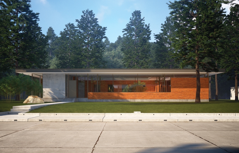
Project Cheatham Residence, Dallas Client Diane and Chuck Cheatham Architect Tod Williams Billie Tsien Architects | Partners Design Team Tod Williams, FAIA; Billie Tsien,…


West Texas is loosely defined as the part of the state that lies west of the 100th meridian, the geographical line that forms the eastern edge of the Panhandle. West Texas encompasses arid and semiarid lands with classic names such as the Trans-Pecos, Llano Estacado, Rolling Plains, and the Edwards Plateau. The major metropolitan areas include El Paso, Lubbock, Abilene, Midland/Odessa, and San Angelo. These cities have a common denominator: Water is precious.
In light of this fact, William Truitt, AIA, and Marsha Bowden, AIA, have created an elegant and specific direction for new growth in Lubbock, showing a way forward through thoughtful design. Truitt, an associate professor at the University of Houston and design director at Morris Architects, along with Bowden, a former student (now a colleague at Morris) has been studying how the rapid urbanization of cities throughout the world might overwhelm their respective environments. For the past 10 years, they have studied numerous locales, including Mumbai in India, Phnom Penh in Cambodia, Ho Chi Minh City in Vietnam, and Houston. Their work focuses on how modern technological interventions in urban areas are rapidly put into place in order to overcome problems associated with urbanization, and how these interventions are playing out in the long term. Most recently, they entered a competition that was organized by the Los Angeles-based Arid Lands Institute. The competition sought newer, better, more sustainable ways of dealing with the increasing desertification of cities west of the 100th meridian. Where most entries in the competition addressed cities far west of the line (in California, Nevada, and Arizona), Truitt and Bowden were intrigued with the city nearest the line: Lubbock.
“Playa Lubbock,” their entry, was accepted for exhibition and is a compelling look at a troubling phenomenon. Using layered graphics and a genuine understanding of the history of urban sprawl, they argue that, when Lubbock was settled, around 1890, 19th-century attitudes reflecting mastery of the natural world were imposed on the wide-open spaces of the Panhandle. The major avenues of Lubbock were laid out on a one-mile grid, a convenient measure that holds a certain Enlightenment sensibility, as it allows easy division for land use and ownership.
However, a grid doesn’t consider natural features. The area is dotted with shallow depressions in the flat landscape, misnamed playas (beaches) by the Spanish explorer Coronado as he headed west in search of gold. These playas have served to filter rainwater and to recharge the Ogallala Aquifer, which stretches from Texas to Nebraska. The aquifer has been the mainstay water source for the region since it was settled, but its level has dramatically declined in the past 50 years to meet the demands of urbanization and agriculture. The nearby Brazos River and the reservoirs that were built and used to supplement the aquifer are very low or mostly dry.
Through the decades, as the gridded land began to be developed, the playas were treated as obstacles to overcome. Many were turned into parking lots, small parks, golf courses, or irrigated farm circles. When the rains do come, the impervious surfaces of the city’s sprawl trigger serious flooding. To alleviate this problem, the City of Lubbock has invested in large-scale and costly underground infrastructure that takes the stormwater away from flood-prone neighborhoods and moves it to retention ponds outside the city. A result is that the water fails to trickle down and recharge the aquifer.
This seemingly insignificant intervention on the land has had unintended effects over time. For example, growing and irrigating crops where once only native grasses existed has allowed the city to flourish, but the water required no longer supports both the population and the crops. The non-native species of grasses and crops that were planted to sustain livestock and develop agriculture ended up requiring larger, mechanical means of irrigation. As the region became a hub for the supply of livestock to the beef industry around 1950, crop irrigation increased exponentially. Tapping the aquifer was an easy mechanical solution and was treated as a permanent fix in an inhospitable landscape. With the land seemingly mastered, development of the square mile grid has continued with little planning involved, much like Houston. Crop circles exist next to suburban houses, next to retail strip malls, next to golf courses. The occasional New Urbanist townhome subdivisions, while creating pockets of density, are private, gated enclaves that don’t attempt to respond to the gridded street edges.
Playa Lubbock proposes a way to improve the relationship of built space to the natural ecology, while retaining the pattern of the grid. It leverages the existing slight topography of the land along with developer-driven urbanization, creating a new direction for growth. A simple and direct investment in a visible infrastructure combining technology, native landscaping, urban development, and aquifer regeneration appears to trump a costly, unseen mechanical engineering system. The graphics show a series of phases for development, allowing the gradual habitation of the gridded land alongside existing and proposed playas. The current urban and rural road network, laid out in square miles, provides the background for a network of independent water retention landscapes. This allows for density at the intersections between the square miles — something that was planned in the initial rural structure set in place in the 1890s, but that was ignored in the suburbanization of the city.
Additionally, compact residential and commercial space, planned at the corners, allows for large-scale landscapes instead of small parks and golf courses. Each developed grid square builds a passive graywater system into the slope between commercial and residential space. Water accumulates in aquifer-recharging playas after passing through a series of natural filters and tanks. The system has the ability to absorb individual differences within a site, be they geographic or constructed. The approach here could be a model for similar Great Plains cities with increasing population demands and typical suburban development.
Having been raised in perennially dry West Texas, I find that most towns and cities in this part of the country are struggling with similar issues: How does infrastructure meet our growing needs? How can we afford the infrastructure we must have? Can we grow intelligently in the midst of resources becoming more scarce? How will climate change affect us? And most importantly, where will we get our water?
“If we continue to grow,” Truitt says, “we can only modernize ourselves out of a problem for so long.” He and Bowden wrote in their proposal: “There are ways of developing the landscape and working with the resources we have, while also developing infrastructure that allows for habitation increases on par with projected rates. The Playa Lubbock project uses the natural shallow tank to show that infrastructure and living space can rest together within the standard property division of one square mile. They are not mutually exclusive.”
With the population of Lubbock slowly but steadily growing, and with the continued drilling of wells into the aquifer to irrigate large-scale farming operations, current models of growth seem inadequate for the days ahead and appear unsustainable. My hope is that Playa Lubbock will awaken us to a different way of thinking and initiate a new direction for development.
Craig Kinney, AIA, is an architect in San Angelo.