A Caprock and a Hard Place
Lubbock has master plans in the works to invigorate and connect downtown and the Canyon Lakes, plans that put the historically black neighborhood of Dunbar-Manhattan Heights in the development crosshairs.
A quarter of a million people straddle the high Western Plains of the Caprock Escarpment, where the horizon stitches land to sky in a single dark line. The dry air sticks in your throat, coating it with clay and caliche dust. Massive white turbines turn wind to power, standing sentinel over the miles and miles of cotton below. Lubbock is a flat, nearly featureless place, scored by small transitory streams and narrow canyons that drain into the recurrent and unpredictable shallow pools called playa lakes. Highways from all directions run like spokes on a wheel straight to Hub City, which is bisected by the BNSF Railway. Missing from local guides is an explanation of how Lubbock’s history continues to be shaped by the cotton gins — colossal superstructures looming like ancient temples over intermittent outcroppings of homes and dead-end streets, all zoned uncomfortably close. In Lubbock, as in most cities across the U.S., hidden in industry’s shadows are the real stories of revitalization and urban growth: Communities, most of which were historically home to Black families, Indigenous people, and people of color, are being crushed between infrastructure and developers’ dreams.
In June 2020, Lubbock City Council unanimously approved a Downtown Master Plan Update produced by Overland Partners. The goal of the plan is to reconnect Texas Tech University, located on the west side of town, with the Canyon Lakes on the east. Constructed by the city starting in the 1970s, the lakes are a significant yet underutilized local amenity, offering scenic views and recreational opportunities. The plan proposes connecting these to the university through an activated downtown corridor along Broadway Avenue. While Overland Partners met the scope of the city’s goals, did they consider the whole picture? The broader view includes the historically disadvantaged communities of color immediately adjacent to downtown and the industrial zoning areas these residents are concerned about. However, their voices were dismissed at city council meetings as “irrelevant” to the process, and they were not included as stakeholders in the recent master plan update.
Overland Partners’ study of Downtown Lubbock echoed the city’s urgency. They hosted four two-day workshops, only one of which was open to the public. This public workshop was held mid-week at 9 a.m. and 10 a.m., prohibiting participation by most working people. Designing and planning for the public is a challenging endeavor even for the most experienced of architects, but an attempt should be made to create places that reflect their unique character, places that speak to a diversity of experience. The 2020-21 Lubbock city budget calls for a new parks master plan, and it seems evident that the Canyon Lakes will be a significant aspect of this. But downtown districts and public green spaces are amenities for all community stakeholders in a city, and rushing through the planning stage winds up excluding the people who are living in those neighborhoods that will be impacted the most.
The railroad and the Canyon Lakes are both significant human interventions in Lubbock’s urban landscape. In 1909, the arrival of the railroad made farm-to-market access easier and increased immigration to the region. Arduous agricultural and industrial labor were often the only work African-Americans and Mexican-Americans were offered, and xenophobic housing policies forced them to live east of the railroad, in the backyards of many of the plants and farms that employed them. In spite of this legacy of redlining, vibrant cultures began to develop on the east side, in what was known as “The Flats.” In his 1974 Texas Tech history thesis, Robert L. Foster described the term “flats” as possibly being “derived from other sections of the Old South,” where it “was used with more accuracy to describe the black section which was often in the river bottom.”
Lubbock’s industry, agriculture, and segregation are intertwined. Prior to 1970, the railway, which runs parallel to Yellowhouse Canyon, was a dumping ground for businesses, and items such as junked cars and refrigerators were common sights in the basin. It is hard to imagine trash being piled up in the beautiful ravines today.
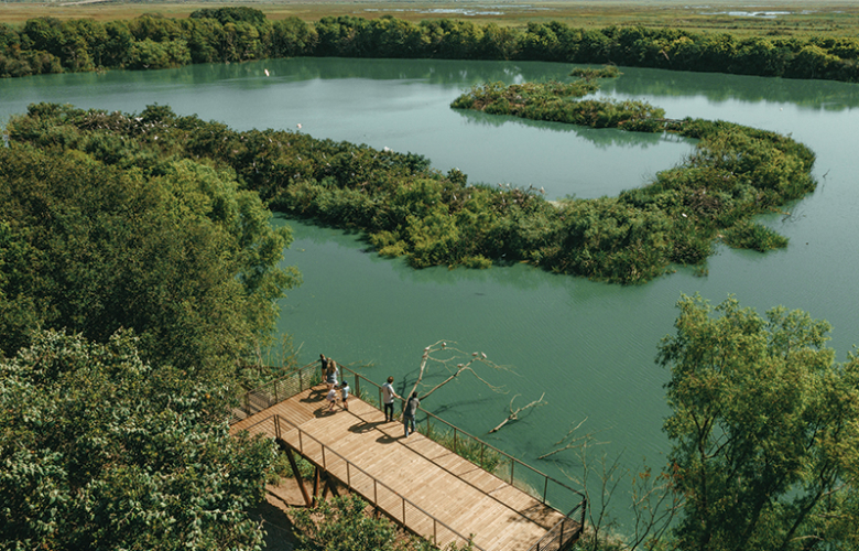
The Canyon Lakes are a chain of reservoirs that run along the northeast edge of Lubbock and reveal the ingenuity and sheer tenacity of a city defined by drought. Here, the word “water” is drawn out, spoken in a slow, unmistakable drawl and accented with a twang of doubt. “Do you know how the Canyon Lakes gets its water?” former Director of City Planning Jim Bertram asks rhetorically. “It’s one of the nation’s largest water reclamation projects.” In 2001, the city of Lubbock renamed the Canyon Lakes the Jim Bertram Lake System in honor of his extensive work to direct their implementation.
Bertram first became aware of the potential for developing the canyons into lakes as a young city planner for Lubbock in the 1960s. Around that time, San Antonio was beginning to redevelop the River Walk, but the real inspiration for the project came from the city of Santee, California, 22 miles northeast of San Diego. “They were using third-stage tertiary in-plant treatment,” Bertram remembers. For Lubbock, plant treatment of effluent water was cost-prohibitive, so the city focused on a more abundant resource in the high plains: land. Since 1938, effluent water coming out of the water treatment plant had been pumped onto farmland outside of Lubbock in the southeast, giving the eastern approach to the city a signature odor. The idea was for water from the farm, which was filtered through the ground, to be used to help fill the canyons, but it would need to be pumped to the northernmost canyon to let it cycle by gravity through the lakes. The magnitude of the project was overwhelming.
In the original plan, there were eight lakes, and so far, the first six inside the city are completed. The initial concept was that the larger lakes, yet to be built, could be used as a domestic water source for Lubbock. Currently, plans are filed with the state of Texas to build Lake Seven south of the city and upstream from Buffalo Canyon. The ravine at this place is narrow but very deep, which translates to a lot of storage and less surface area for evaporation.
On May 11, 1970, a catastrophic F5 tornado tore a 1.5-mile-wide scar across the downtown business district. Locals still recall their fathers pulling people from the wreckage. Curtains fluttered from where the winds pried the roof from the walls before dropping it back down. Seeing the devastation only confirmed to the West Texans that they needed a place of respite and beauty to call their own. Despite the enormous cost of rebuilding, voters determined that the number one goal of the recovery bond was the Canyon Lakes Project. Bertram was tapped to direct the planning, oversee the disaster cleanup, and implement his plan for the canyons. “Canyon Number One was a large caliche mine, so the Corps of Engineers saw that as a handy place to put tornado debris,” Bertram says. They used bulldozers to compact the rubble and fill in the caliche pit, returning the canyon to its pre-mining shape and size.
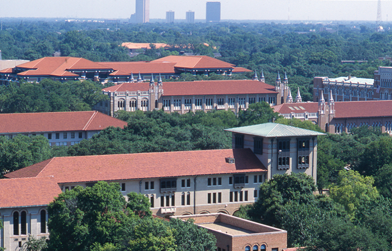
Lubbock is a young city. Founded in 1890, it has spent nearly half its existence seeking to reinvent itself after the tornado. Many of the city’s buildings are deeply connected to a mythical view of the once-wild West. Texas Tech University’s Spanish Colonial revival architecture boasts of conquest and conquistadores. Long, low shopping centers and hotels honor symmetry and embellishments that reference Spanish Missions. Brown suburban homes stand neatly along dusty extra-wide roads. Surrounding the urban center are vernacular commercial buildings shaped for function and longevity. It’s hard to ignore the candor of these modest structures rooted to the ground, all sharing the same goal of permanence.
In the 1920s, lots in Lubbock’s historically black neighborhoods measured 26 ft across the front and sold for 50 to 75 dollars. These lots allowed for long, narrow wood-frame houses that were usually financed by lumber companies for around $500, according to Foster’s research. Artist and local photographer Eugene Roquemore captured the rich history of life in East Lubbock with photos that highlight everyday experience. His images, as well as others, show parades, gas stations, bakeries, diners, skating rinks, convenience stores, grocery stores, fruit stands, and hamburger stands that are now only memories in the neighborhood.
East Lubbock is full of stories. The legendary bootmaker Willie Lusk, known for his signature flame stitch, gained notoriety with his thorough mapping of the customer’s foot that marked every ridge. He sold his boots to such celebrities as Shirley Temple, Ronald Reagan, Betty White, and Merle Haggard. His tradition continues with T-Mack Millennium Designer Boots, by Thomas McLin, whose designs often stitch stories that are close to his heart and that feature a distinctive pocket on the side. “These are my favorite,” he says, picking up an elegant pair of white leather boots detailed with the date and imagery of the Gettysburg Address.
McLin is a talented designer, business owner, and resident of the Dunbar-Manhattan Heights neighborhood, named after the first African-American high school in Lubbock, which in turn was named in honor of poet Paul Laurence Dunbar. Access to the enclave is limited to a bridge from 19th Street to Martin Luther King Jr. Boulevard to the north, a bridge over the BNSF Railway yard to the west, and a bridge from M.L.K. Jr. Blvd. to 34th Street in the south. During winter, the bridges freeze, making the way into and out of the neighbored treacherous. Dunbar is pressed against the eastern edge of the largest Canyon Lake, Number Six, where a former open-air landfill and caliche pit once gaped. This compression reveals a fundamental housing inequity long ignored by zoning regulations that place commercial interests before human life.
One of the last remaining cotton seed oil mills in the world blocks the southern edge of Dunbar. Local historian and treasurer of the Lubbock Roots Historical Arts Council Cosby Morton explained the community’s dependence on it: “You have to be pretty careful about the cotton oil mill, because [they were] the only people who would give us jobs. But, out of that, you get stories of people surviving.” The jobs were dangerous; workers risked being injured and maimed by equipment. More insidious effects are the rampant asthma and other respiratory illnesses that still pervade life in the community. Cosby mentions fits of coughing and wheezing, and several other residents nod in agreement. Stepping outside, it’s hard to ignore the acrid smell of chemicals that winds through the streets as families celebrate the warm spring weather in their yards.
The arts council meets in the Roots Community Revitalization Center, a humble brick building on Avenue A. Down the street is the Caviel Museum of African-American History, a building donated to the council by the family of Alfred and Billie Caviel, whose pharmacy was the first in the U.S. to be owned and operated by an African-American couple. As its mission, the Roots Historical Arts Council “seeks to enrich life by promoting a greater understanding of the African-American experience through the practice and appreciation of the visual and performing arts and through the study, interpretation, and preservation of the history of the African-American in the Early American West.” The museum is one way they can do that, but funding is tight. Executive Director Shirley Green knows this personally. She used her own money to keep the electricity on during the last year. “It’s hard,” she says. “We are open by appointment only, and we are all-volunteer operated. This is your place in the community for you to have somewhere to go and meet. With the museum, we are trying to restore our history. We want to reach out to the young people and let them know what your roots are — where you came from and what your relatives done. I’m from East Lubbock, and I’m very proud, because when I came up, we had everything we needed because urban renewal hadn’t set in yet.”
By “urban renewal,” Green means the 1949 Federal Housing Act, which altered cities across America with brutal effects that began to excise East Lubbock from its foundation. This program was used to take land deemed a “slum” through purchase or condemnation, then to clear and sell it to developers who promised to improve the lot. Safeguards were not included, and most of those lots remain vacant, awaiting justice. Lubbock District 2 Councilmember Shelia Patterson Harris, who represents Dunbar, sums up the history concisely: “Urban renewal is often called ‘urban removal’ for a reason.”
This history is precisely why a project like the development of the Canyon Lakes is so critical for vulnerable neighborhoods like Dunbar. A beautification effort and the expansion of miles and miles of linear park will require that the lakes take on a performative role as well as a recreational one. This type of oversight and investment should include the residents of adjacent neighborhoods like Dunbar-Manhattan who will be priced out of their communities if strong housing protections are not included in the codes as part of any Canyon Lakes master plan.
Lubbock’s Canyon Lakes are undoubtedly a sustainable and precious resource for the city, but even during the project’s initial phases, a chilling optimism was linked to the early water performance goals. A 1975 graduate civil engineering thesis from Texas Tech entitled “A Pilot Study of the Canyon Lakes Project” speculates that the increasing land values due to the Canyon Lake improvements will “achieve the goals of conventional urban renewal projects at a fraction of the cost. Therefore, it could set a precedent for a national program of development of similar projects.” What this language reveals is what designers already know: Our work creates a model for others to follow. By overlooking people without the means to be heard, we continue a legacy of exclusion.
Councilmember Patterson Harris remains optimistic about the possibility of revitalizing the Canyon Lakes park space as a bridge to reconnecting the east and west sides of the city, but she emphasizes the need to reach out directly to the community of Dunbar-Manhattan for residents’ input on any development. She says: “Juneteenth is held in Mae Simmons Park, and the parks are used for fishing, canoeing, paddle boat business, and kayaking. In 2019, an Iron Man qualifying event was held at Dunbar Historical Lake with over 1,000 people participating. The opportunity is there. The ideas are limitless, but people have to be walked through being receptive [to the development].”
Kristine Stiphany, PhD, AIA, an architect, an assistant professor at Texas Tech University, and founder of the Chapa Civic Data Lab, recently conducted a seminar entitled “Design for Resilient Environments,” which brought students face to face with the realities of urban design through the creation of a design research field guide and framework plan. “My graduate studios at the Texas Tech University College of Architecture typically travel to Latin America to engage questions of socio-spatial segregation and informal housing,” Stiphany says. “However, in the fall of 2019, I saw an opportunity to focus on these wicked problems in Texas’ backyard.” After learning about how Lubbock, like most cities in the U.S., historically segregated African-American communities, and that these racialized practices centered on Dunbar-Manhattan, Stiphany began engaging the community through the Texas Housers (the Texas Low-Income Housing Information Service). By January 2020, she concluded that a housing needs assessment could be a mechanism for listening to the community, and that the City of Lubbock could use it to make improvements across the east side.
As Lubbock grows, there is an opportunity to take a different approach, one aimed at unraveling the inequitable ways that issues of urban structure, buildings, and public spaces are tied to policies and zoning that continue to create racialized landscapes in U.S. cities. In support of the seminar and Phase One project, Stiphany, in collaboration with the Texas Housers, directed a community engagement process which revealed the following five key challenges, based on planning documents in Lubbock and focus groups and interviews with residents:
1. Dunbar-Manhattan Heights’ isolation by pollutant land uses, heavy infrastructure, and the Canyon Lakes reinforces historical patterns of socio-spatial segregation and injustice.
2. Dunbar-Manhattan Heights has been continually dispossessed of commercial and cultural assets, and persistently segregated socially and spatially through urban renewal efforts.
3. Dunbar-Manhattan Heights, a neighborhood planned in the 1960s, lacks contemporary proposals and investment to improve the community’s housing and livability.
4. Dunbar-Manhattan Heights is located adjacent to natural resources that residents cannot access.
5. Dunbar-Manhattan Heights is housing-insecure and vulnerable to evictions and to the practice of “flipping” homes from owner-occupied to rental.
East Lubbock and Dunbar-Manhattan are not isolated cases. Areas like Houston’s Fifth Ward along Buffalo Bayou, South Dallas near Fair Park, and the Rio Grande Valley’s colonias, which run along the Texas-Mexico border, share this history of segregation and injustice. When Cosby Morton is asked about what he wants from future revitalization efforts in East Lubbock, he has a simple request: “Recognize that we are part of the city.” Lubbock is Willie Lusk, Thomas McLin, Eugene Roquemore, Mae Simmons, Vivian T. Cooke, Eric Strong, E.C. Struggs, Dr. Joel P. Oliver, Alfred and Billie Caviel, and countless others. Their stories are what we are at risk of losing when we do not include everyone in the design process. Great design begins with uncovering the complete truth of a place and then aspiring to more.
Jes Deaver, AIA, is an architect in Austin.

Also from this issue
